First customer
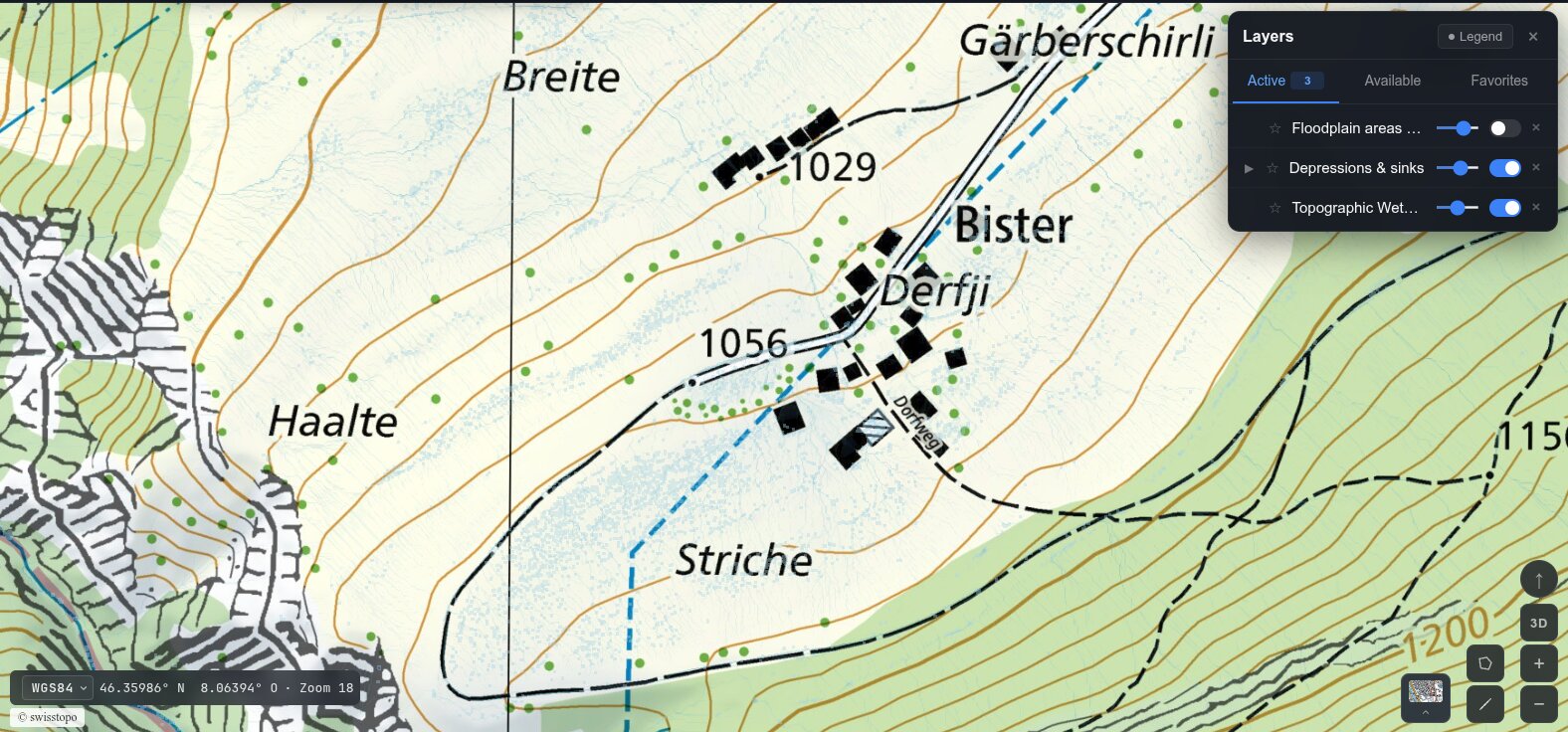
Municipal GIS for the municipality of Bister
Gemeinde Bister is the first municipality to adopt firntec-GIS, our web GIS platform for Swiss municipalities. It goes beyond official cadastral data and swisstopo maps: from the elevation model it computes a physics-based hydrology simulation, showing depressions and sinks, topographic wetness and the expected rainfall runoff across the area. Building (GWR) and resident data are imported via the eCH/sedex interfaces, linking geodata with municipal records for spatial analysis.
Angular
FastAPI
PostGIS
Martin Vector Tiles
eCH/sedex